Get a Free Quote Today!
Make an Appointment Today
Service
What Is Drone Inspection and Aerial Property Assessment?
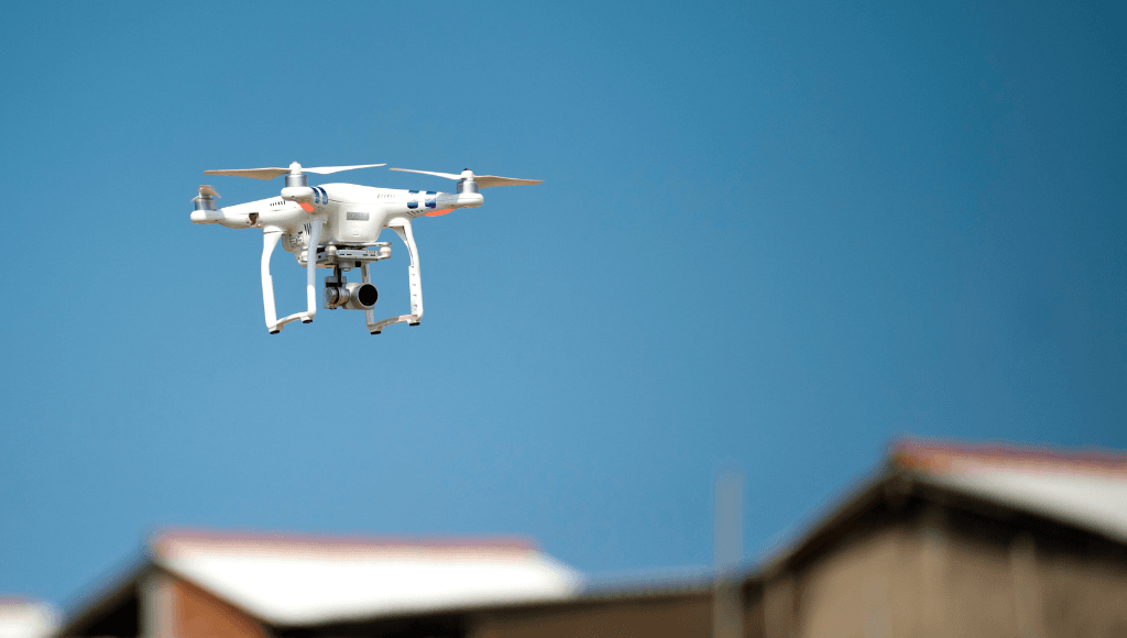
Drone inspection uses unmanned aerial vehicles equipped with high-resolution cameras to safely examine roofs, gutters, chimneys, and other elevated areas. Professional drone inspection provides detailed aerial photography and video documentation of areas too dangerous or difficult to access by ladder.
Here’s what that means for you: You’ll get thorough inspection of hard-to-reach areas without safety risks, ladder damage to your property, or expensive equipment rentals.

What We Inspect During Your Drone Inspection
Storm Damage and Insurance Documentation
- Hail damage, wind damage, and weather impact assessment
- Insurance claim documentation with aerial photography
- Before and after storm comparison documentation
- Detailed damage mapping and location identification
Large Property and Comprehensive Site Assessment
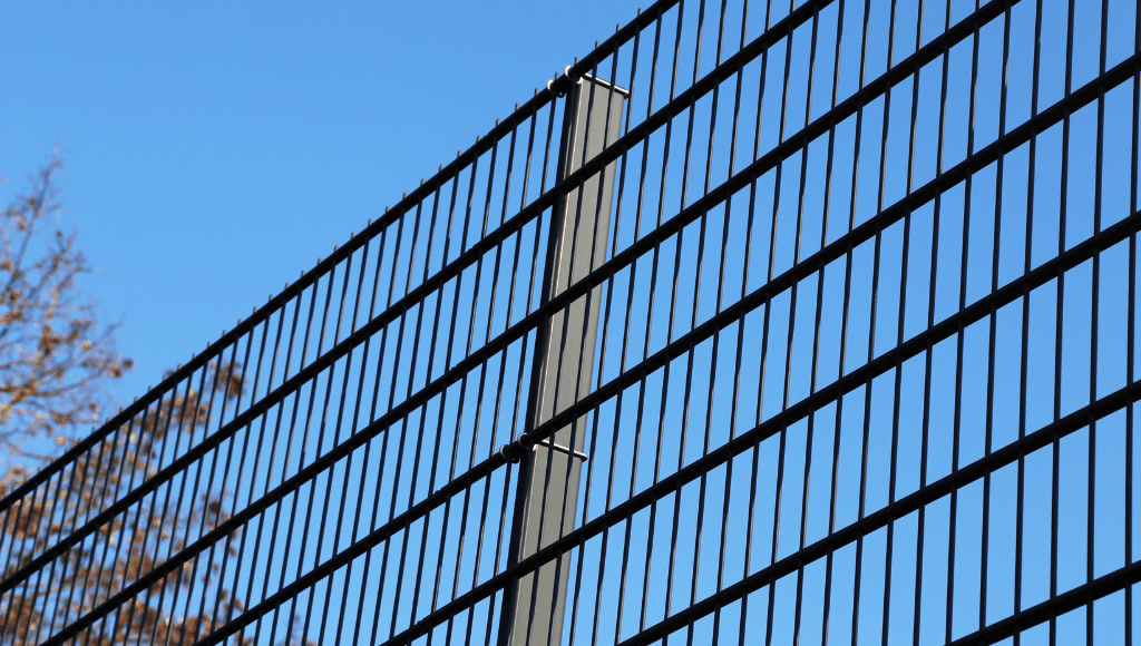
- Property boundaries, fencing, and perimeter conditions
- Outbuildings, barns, and detached structures
- Drainage patterns, grading, and site conditions
- Environmental concerns and access limitations
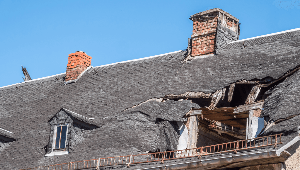
Roof System and Aerial Assessment
- Roof surface condition, shingles, and missing materials
- Gutter systems, downspouts, and drainage components
- Chimney condition, flashing, and cap assessment
- Roof penetrations, vents, and HVAC equipment

Multi-Story Building and Tall Structure Inspection
- Upper level siding, trim, and exterior conditions
- Windows, doors, and architectural details at height
- Commercial building roofs and structural elements
- Cell towers, water tanks, and industrial structures
Professional Drone Inspection Near Me in Kentucky & Ohio
Safety First for Steep and High Roofs
Kentucky and Ohio homes often have steep roofs, multi-story construction, and challenging access. Drone inspection eliminates fall risks while providing thorough assessment.
Weather Damage Assessment
Our region experiences severe weather including hail, wind, and ice storms. Drone inspection safely documents storm damage for insurance claims and repair planning.
Technology That Makes a Difference
I use thermal imaging cameras and moisture detection equipment to find hidden problems other inspectors might miss. But the real value is knowing what I’m looking at when I find something.
What You Get with Your Drone Inspection
High-Resolution Aerial Photography and Video
- Detailed aerial photos of roof and property conditions
- Video documentation of problem areas and overall condition
- Before and after comparison photography for repairs
- Digital files suitable for insurance claims and contractors
Comprehensive Aerial Assessment Report
- Written documentation of all aerial findings
- Problem area identification with precise location mapping
- Condition assessment and repair priority recommendations
- Professional analysis combining aerial and ground observations
Safety and Access Solutions
- Inspection of dangerous or inaccessible areas
- No ladder damage to gutters, siding, or landscaping
- Efficient inspection of large or complex properties
- Weather-appropriate timing for optimal visibility

Who Needs Drone Inspection Services?
Homeowners with Steep or High Roofs
Multi-story homes, steep roofs, or complex rooflines benefit from drone inspection that eliminates safety risks while providing thorough assessment.
Property Owners After Storm Damage
Hail, wind, or storm damage assessment requires safe documentation for insurance claims and repair planning without risking inspector safety.
Commercial Property and Investment Property Owners
Large buildings, warehouses, and commercial properties need efficient inspection methods that cover extensive roof areas and building systems.
Rural Property Owners with Multiple Buildings
Farms, estates, and rural properties with barns, outbuildings, and extensive structures benefit from comprehensive aerial assessment.
Drone Inspection Regulations and Compliance

FAA Part 107 Commercial Drone Operations
- Licensed drone pilot with commercial certification
- Compliance with federal aviation regulations
- Airspace authorization and flight safety procedures
- Insurance coverage for commercial drone operations
Property Rights and Privacy Considerations
- Respectful operation within property boundaries
- Privacy protection for neighbors and adjacent properties
- Professional conduct and property access coordination
- Clear communication about inspection scope and timing
Advantages of Drone Inspection Technology
Safety Benefits
- Eliminates fall risks for inspectors and property owners
- No ladder contact with gutters, siding, or roofing
- Safe inspection during adverse weather conditions
- Reduces liability and insurance concerns
Inspection Quality and Efficiency
- High-resolution imagery reveals details invisible from ground
- Comprehensive coverage of large or complex structures
- Multiple angles and perspectives for thorough assessment
- Efficient inspection of extensive roof areas
Documentation and Verification
- Permanent photographic record of property condition
- Time-stamped documentation for insurance and legal purposes
- Shareable digital files for contractors and insurance adjusters
- Before and after comparison capabilities

Common Issues Found During Drone Inspections
Roof System Problems
- Missing, damaged, or loose shingles and roofing materials
- Gutter damage, separation, and drainage problems
- Flashing failures around chimneys and roof penetrations
- HVAC equipment installation and mounting issues
Structural and Exterior Concerns
- Siding damage, trim problems, and exterior deterioration
- Window and door condition at elevated levels
- Chimney damage, cap problems, and structural issues
- Architectural detail deterioration and maintenance needs
Storm and Weather Damage
- Hail impact damage on roofing and gutters
- Wind damage to shingles, siding, and structures
- Tree damage and debris accumulation
- Ice dam damage and winter weather impacts
Large Property and Site Issues
- Outbuilding condition and maintenance needs
- Fencing, gate, and perimeter structure problems
- Drainage issues and grading problems
- Access and safety concerns for maintenance
Drone Inspection Process
Schedule Your Aerial Inspection
We’ll coordinate timing based on weather conditions, property access, and any specific concerns about roof or elevated areas requiring assessment.
Pre-Flight Planning and Safety Assessment
I’ll evaluate flight conditions, airspace restrictions, and property layout to ensure safe and effective drone operation for your inspection.
Comprehensive Aerial Documentation
Professional drone equipment captures high-resolution photos and video of all elevated areas, focusing on problem areas and overall condition assessment.
Ground-Level Verification and Analysis
Aerial findings get verified with ground-level inspection where possible, combining perspectives for comprehensive property assessment.
Detailed Reporting and Documentation
You’ll receive complete aerial documentation with analysis, problem identification, and recommendations for any needed repairs or maintenance.
Ready to See Your Property from a New Perspective?
Don’t risk safety on ladders or miss problems you can’t see from the ground. Professional drone inspection provides comprehensive aerial assessment.
Frequently Asked Questions About Drone Inspection
How much does drone inspection cost?
Drone inspection typically costs $200-500 depending on property size and complexity. This investment provides safe, thorough assessment without safety risks.
What weather conditions affect drone inspection?
Wind, rain, and poor visibility can postpone drone flights. We schedule flights during optimal conditions for safety and image quality.
Can drone inspection replace traditional roof inspection?
Drone inspection supplements but doesn’t completely replace ground-level inspection. We combine both methods for comprehensive property assessment.
How detailed are the aerial photos and videos?
Professional drone cameras provide high-resolution imagery that reveals details often missed from ground level, including close-up views of problem areas.
Do you need permission to fly drones over my property?
We operate within your property boundaries with your permission. We handle any required airspace authorizations and comply with all regulations.